


Innovation and quality: drones in agriculture
Our agricultural drone services help farmers and agribusinesses with crop monitoring, aerial spraying and the transition to precision agriculture. Start optimising your farm's expenses today. Choose our drone solutions to significantly reduce your costs!
LANDRONE
FOR AGRO

Flexible and tailor-made solutions - we welcome your enquiry!
Aerial surveying and monitoring

During our aerial survey, we determine the exact position of the entire area to the nearest centimetre, as well as any obstacles and objects
that may be present. With the survey data, we can also deploy the spraying drone for spot treatments.


Regardless of terrain and soil conditions, we are able to fly over waterlogged, water-saturated ground. During the site survey, our drones capture high-resolution aerial imagery, and the analysis software provides tangible and easy-to-interpret data.
Multispectral aerial imagery for plant disease detection

Making current and accurate agricultural information more readily available. We are your gateway to crop health and soil moisture monitoring.
You can increase yields and reduce costs with our analysis.


Quickly identify and address plant disease, pest infestation or poor irrigation that may not be detected by ground level inspections. Analysis tools such as Normalised Differential Vegetation Index (NDVI) help you to zero in on conditions, compare them and make adjustments to maximise your yield. Monitor and assess crop health faster and more accurately over large areas using topographic, thermal and spectral mapping.
Precision crop spraying

With a performance of 10-15 hectares per hour, difficult areas become manageable, and the damage caused by traditional spraying, such as soil compaction, is eliminated.


Our spraying drone's radar tracks the height of plants, ensuring a more consistent application. Based on the data from the monitoring drone, it can accurately spray designated areas, orchards, vineyards, nurseries or horticultural gardens. If the weather suddenly changes, it can resume spraying with centimetre accuracy. Unlike conventional spraying, the drone can be used on wet, waterlogged ground. During the spraying process, we can achieve savings of almost 90% in water and a considerable amount of pesticides.
Smart aerial irrigation with drones

With a spraying drone capable of 10-15 hectares per hour, we water and protect your crops from drought without compacting the soil.


Spraying water not only makes it easier for the plants to absorb water, but also helps to create a better thermal balance. The radar on the spraying drone allows it to follow the height of the plants, which makes the spraying process more even.
Drones in forestry

Drones have brought innovations in aerial photography, thermal imaging and surveying to the forefront of forestry management. With their help, ecosystem sustainability can be maintained with greater efficiency.


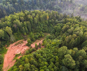
Drone technology is expanding the possibilities for forest management, allowing wildlife and vegetation to be monitored.
Diseases can be detected to keep forests healthy.